Tualatin-Sherwood Rd: Martinazzi Ave to I-5
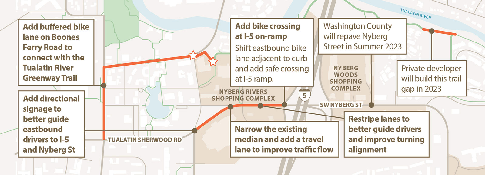
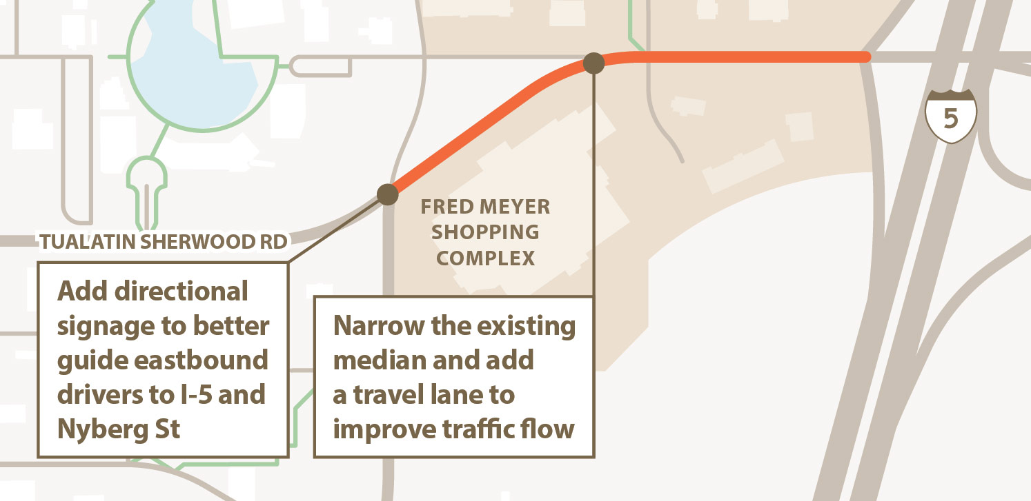
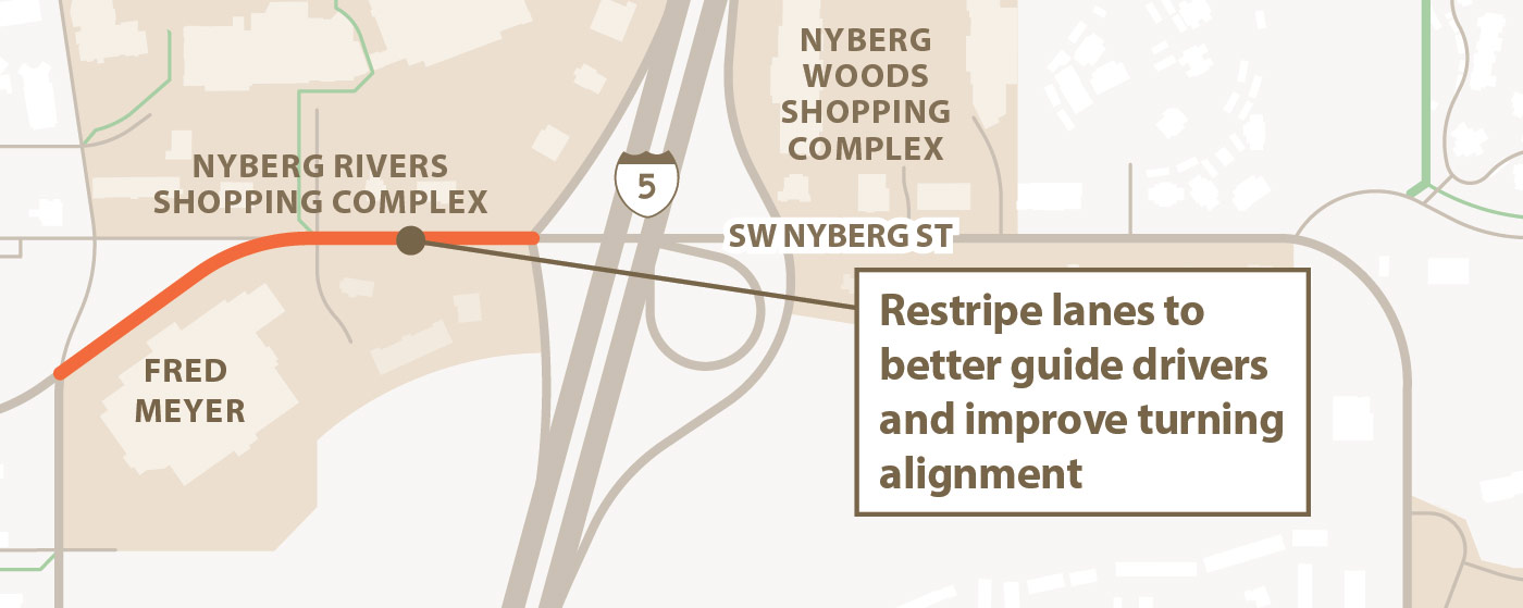
The Tualatin Moving Forward program is funding a project to improve operations and safety of the intersection of Tualatin-Sherwood Rd/ Nyberg St with the Fred Meyer driveway, while also working to improve pedestrian and bicycle safety.
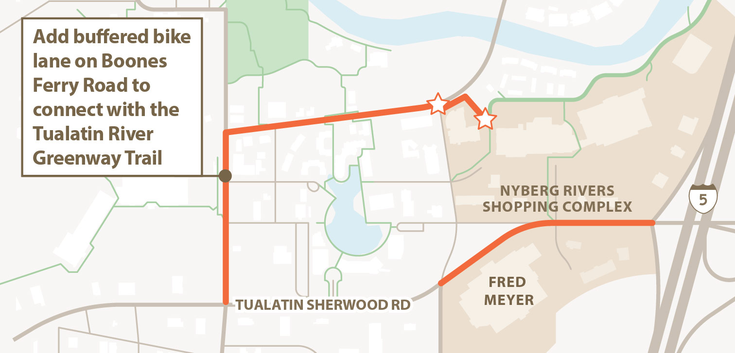
The project will invest in improving access and wayfinding signage to the existing parallel route to the north, the Tualatin River Greenway trail.
What to expect:
- Tualatin-Sherwood Rd / Nyberg Road will remain open throughout construction.
- Flaggers will be used as needed – expect delays.
- Construction will occur at night.
- Some lane closures are planned between 9pm - 5am.
- Anticipate some noise during work hours from 9pm - 5am.
- Some trees and shrubs will be removed along Tualatin-Sherwood Rd, but there will be plantings in their place.
Construction is underway! Work is anticipated to be completed this fall/winter. To receive project updates send an email to jillroszel@altago.com
Click image to enlarge.
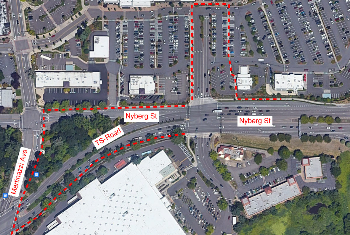
Pedestrian Detour Map
The crosswalks and ramps at the driveway on the north entry access drive of the Fred Meyer will be upgraded to become ADA compliant. The crosswalk will be closed for up to five business days when this construction takes place. Please use this alternate route during this closure.
We’re reducing travel time and increasing predictability for people driving, while making sure the roads aren’t less safe for people walking and cycling through the area.
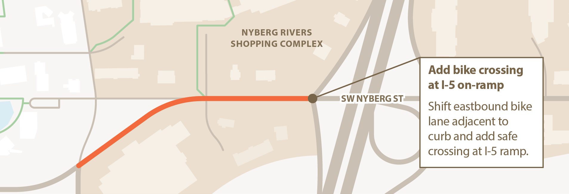
- Shifting the eastbound bike lane so it is next to the curb, and less exposed to traffic, and adding a bike signal at the top of the interchange to help people safely cross the on-ramp.
For questions or to receive quarterly project updates email: tmf@tualatin.gov
